

Here is your forecast for Monday, January 19th, 2026.
It was another chilly start across SWFL. Fort Myers started at 39° (again.) PGD was a few degrees warmer than this past Friday, starting at 36°. Naples started off the morning in the lower 40s.
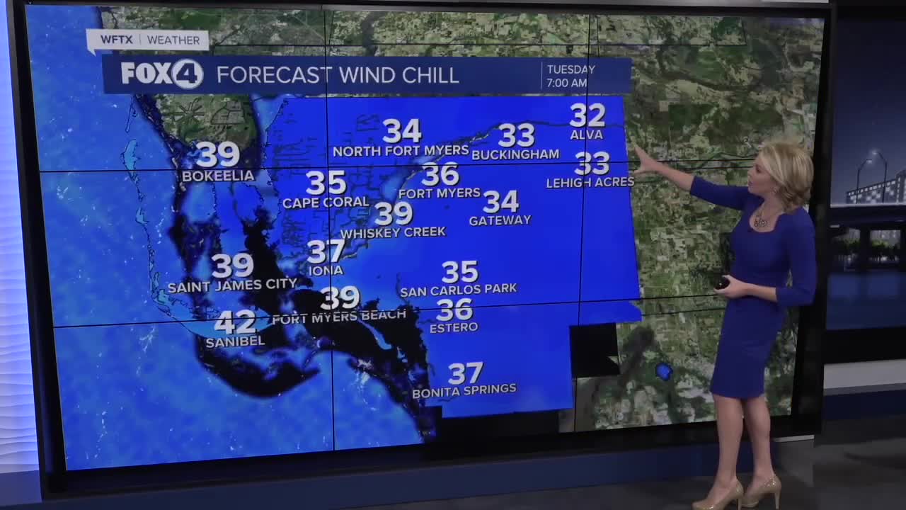
Tomorrow morning will be another chilly start with widespread wind chills in the upper 20s and 30s across SWFL. All of SWFL, except Collier County, is under a Cold Weather Advisory.

It will be a day to layer up, because you'll want the layers in the morning but not the afternoon as highs climb into the lower 70s. Winds will stay breezy with gusts as high as 22 mph.
By Wednesday, temps will be just shy of 80°. An approaching cold front will fizzle out across north FL midweek, keeping temperatures about 5° above normal, around 80° through Friday.
Get ready for nice beach weather this weekend! Saturday will be the warmest day this week with highs in the lower 80s, 5-10° above average, the warm surge ahead of a cold front that will pass through on Sunday. As of now that front is expected to pass through dry. Temperatures early next week will drop into the lower 70s for highs.
FOX 4 EVENING METEOROLOGIST KATIE WALLS
If you don't already have our Fox 4 mobile app, you can download it here.
