

Here is your forecast for Tuesday July 9th, 2024.
Despite the clouds, it was a scorching day across SWFL.
FEELIN' HOT HOT HOT! Despite the overcast sky, temperatures were exceptionally hot again today (even by SWFL standards!) Punta Gorda tied the daily record of 97° with a "feels like" temperature, or heat index, 11° higher. #flwx pic.twitter.com/3gWQQnQZhS
— Katie Walls (@KatieWallsTV) July 9, 2024
Overcast skies today were courtesy of mid and upper level clouds combined with the Saharan Air Layer in the low and mid-levels of the atmosphere. That Saharan dust helps to lessen rain chances, which is why showers and storms were isolated yesterday, today and are forecast to be limited again tomorrow.
IS SAHARAN DUST NORMAL? YES. Saharan Air Layer activity typically peaks from late June to mid-August, with new outbreaks occurring every three to five days. During this peak period, it is common for outbreaks to reach as far west as Florida, Central America and even Texas. This dry, warm air in the low and mid-levels of the atmosphere help to suppress and limit storms.
The Saharan Air Layer will keep us mostly cloudy tonight and again tomorrow. The best chance for isolated showers and storms will be inland after 3pm, as a sea breeze develops. Along and west of I-75, including local beaches, stays dry.
Temperatures will stay muggy with lows in the upper 70s to low 80s this morning. Dangerous heat returns with heat index values between 102-107°.
Drink plenty of fluids, stay in an air-conditioned room, stay out of the sun, and check up on relatives and neighbors. Young children and pets should never be left unattended in vehicles under any circumstances.
Take extra precautions if you work or spend time outside. When possible reschedule strenuous activities to early morning or evening.Wear lightweight and loose fitting clothing when possible.
Our rain chances increase a bit Thursday and Friday to around 40%.
Looking ahead to the weekend, our rain chances increase to 70% each afternoon.
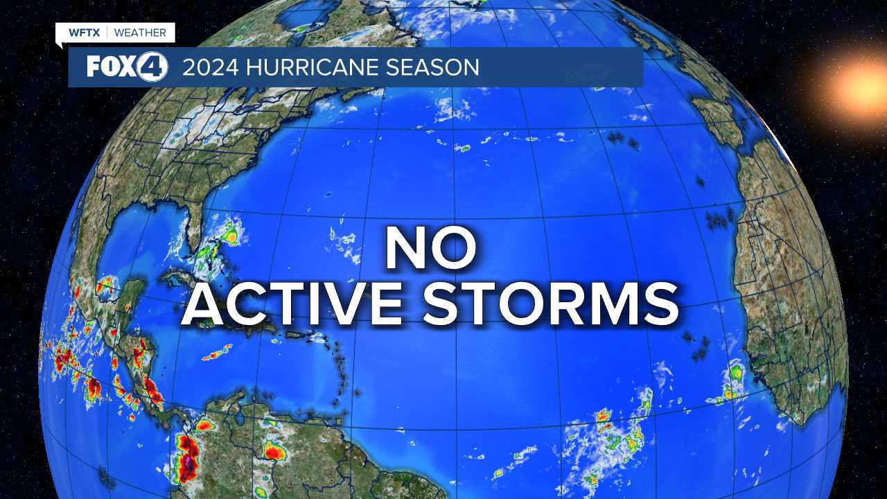
TROPICS UPDATE
The remnants of Beryl continue to produce rain and strong storms in parts of the Ohio River Valley tonight.
No formation is forecast through the next 7-days.
FOX 4 EVENING METEOROLOGIST KATIE WALLS
If you don't already have our Fox 4 mobile app, you can download it here.
