


Thursday, September 11th, 2024:
Hurricane Francine made landfall in Louisiana Wednesday afternoon at 5pm CDT. FOR THE LATEST ON FRANCINE, CLICK HERE.
Tropical Depression 7 is moving toward the west-northwest near 17 mph, and a west-northwest to west motion at a slower forward speed is anticipated over the next few days.
Maximum sustained winds remain near 35 mph with higher gusts. Gradual strengthening is forecast during the next 48 hours, and the depression could become a tropical storm later today or tonight. Next name is Gordon.

Here is the latest on three other areas of potential formation
1. Central Tropical Atlantic (AL92):
A weak area of low pressure located several hundred miles east of the Leeward Islands is producing limited shower and thunderstorm activity. Development of this system is not expected while it moves westward at around 10 mph over the central tropical Atlantic.
* Formation chance through 48 hours...low...near 0 percent.
* Formation chance through 7 days...low...near 0 percent.
2. East of the Leeward Islands (AL94):
Showers and thunderstorms have become a bit more concentrated in association with a small area of low pressure located a few hundred miles east of the Leeward Islands. However, the proximity of dry air near the system is expected to limit additional development over the next couple of days. Environmental conditions are expected to become even less conducive over the weekend while the system moves slowly west-northwestward.
* Formation chance through 48 hours...low...20 percent.
* Formation chance through 7 days...low...20 percent.
3. Offshore the Southeastern U.S.:
In a few days, a non-tropical area of low pressure could form along a residual frontal boundary a few hundred miles off the southeastern U.S. coastline. Thereafter, some subtropical or tropical development is possible during the early part of next week while the system drifts to the north or northwest.
* Formation chance through 48 hours...low...near 0 percent.
* Formation chance through 7 days...low...30 percent.
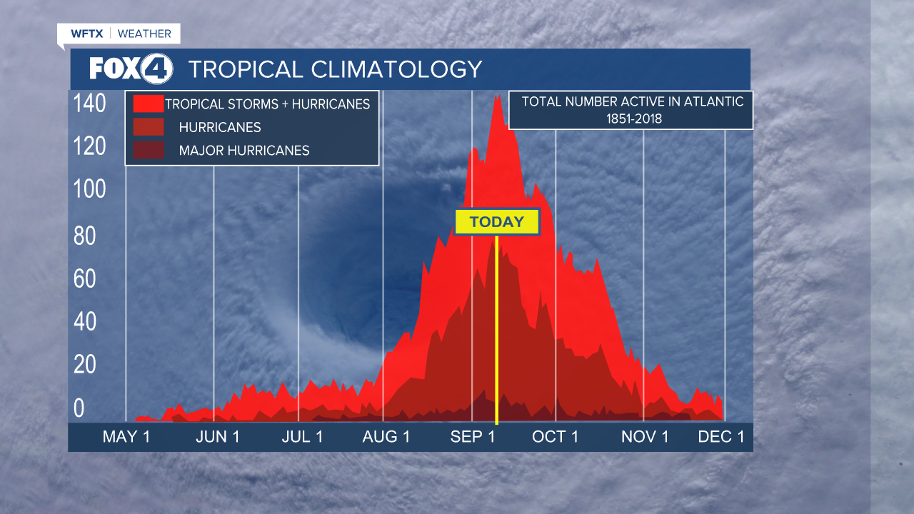
For Southwest Florida, the season tends to stay active through mid-October. The season officially ends on November 30th.
Your Fox 4 Weather Team will keep you updated. For now, these are areas to *watch* but not worry about at this time.
