Now that Debby is no longer around we focus on the next area in the tropics.
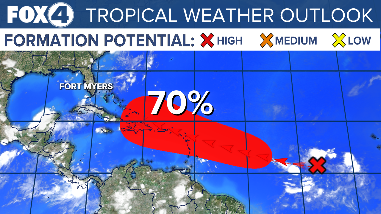
A large area of disorganized showers and thunderstorms located well to the west-southwest of the Cabo Verde Islands over the tropical Atlantic is associated with a tropical wave. Any development of the wave should be slow to occur during the next couple of days while it moves westward to west-northwestward across the central tropical Atlantic. Conditions are expected to become more conducive for development thereafter, and a tropical depression could form by early next week while the system approaches and then moves near or over the Lesser Antilles. The system is forecast to continue moving generally west-northwestward and could approach portions of the Greater Antilles by the middle part of next week.
Conditions are expected to become more conducive for development early next week, and a tropical depression could form while it approaches the Lesser Antilles. The system is then forecast to move generally west-northwestward and could approach the Greater Antilles by the middle part of next week.
This is something for us to monitor and wait for development. Once the system develops, THEN models will have a better grasp on where it may go later next week.
Formation chance through 48 hours is low near 10 percent.
Formation chance through 7 days is high at 70 percent.