UPDATE 8:00PM SATURDAY:
Hurricane Hunter aircraft are on their way to investigate Debby as it moves into the southeastern Gulf of Mexico.
Squally weather is spreading across SWFL from the south. Conditions will deteriorate overnight as the system gradually strengthens but stays offshore from SWFL.
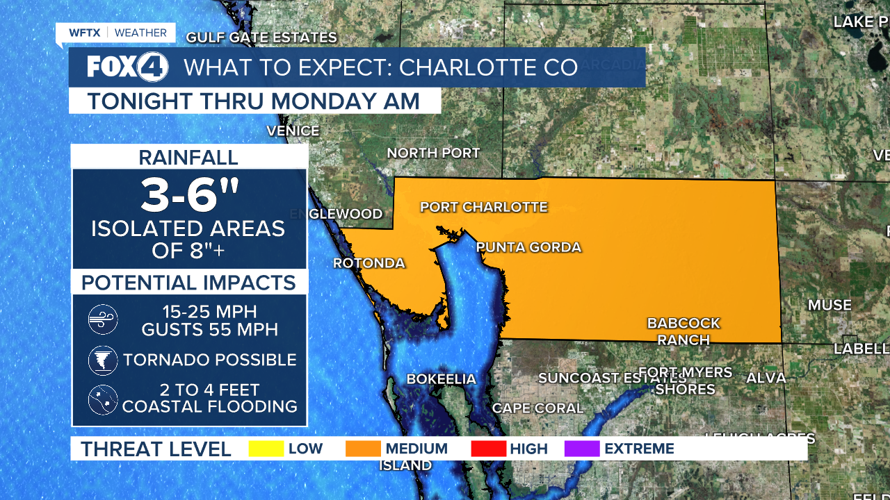
We can expect 4-8" with the highest totals along the coast, tropical storm force winds in excess of 40 mph especially Sunday and coastal flooding, especially during high tide.
UPDATE 4:55PM SATURDAY:
- It's official. TD 4 is now Tropical Storm Debby
- It's now about 100 miles west-southwest of Key West
- Maximum sustained winds are 40 MPH

WHAT YOU NEED TO KNOW:
- Most impacts in SWFL will be tonight into Sunday, when Debby is closest
- Sunday will be breezy with gusts to 45 mph. How far inland gusty winds are depends on how close it is to the coast
- 2-6" of rain are expected through the weekend with isolated higher amounts along the coast
- A few spin up tornadoes can't be ruled out
- Storm surge of 2 to 4 feet are possible from Bonita Beach northward

The system will track near SWFL's coast on Sunday, triggering Tropical Storm Watches and Warnings across SWFL.

A Hurricane Watch is in effect for Indian Pass to Yankeetown. A Hurricane Watch means that hurricane conditions are possible within the watch area. A watch is typically issued 48 hours before the anticipated first occurrence of tropical-storm-force winds, conditions that make outside preparations difficult or dangerous.
A Tropical Storm Warning is in effect for the Dry Tortugas and west coast of the Florida peninsula from south of Yankeetown to East Cape Sable. A Tropical Storm Warning means that tropical storm conditions are expected somewhere within the warning area within 36 hours.
A Tropical Storm Watch is in effect for the Florida Keys south of the Channel 5 Bridge.
A Storm Surge Warning is in effect for Aripeka northward to the Aucilla River. A Storm Surge Warning means there is a danger of life-threatening inundation, from rising water moving inland from the coastline, during the next 36 hours in the indicated locations.
A Storm Surge Watch is in effect for Bonita Beach northward to the Aucilla River, including Tampa Bay and Charlotte Harbor, where 2-4 feet of surge may cause coastal flooding, and west of the Aucilla River to Indian Pass. A Storm Surge Watch means there is a possibility of life-threatening inundation, from rising water moving inland from the coastline, in the indicated locations during the next 48 hours.
Aripeka, FL to Aucilla River, FL...3-5 ft
Aucilla River, FL to Indian Pass, FL...2-4 ft
Bonita Beach, FL to Aripeka, FL...2-4 ft
Tampa Bay...2-4 ft
Charlotte Harbor...2-4 ft

On the forecast track, the system is expected to move into the Straits of Florida and the southeastern Gulf of Mexico on Saturday, followed by a motion near the west coast of Florida Saturday night and Sunday. On the forecast track, the center of the depression will move across western Cuba this morning, and then move over the eastern Gulf of Mexico later today and Sunday, reaching the Florida Gulf coast late Sunday or Monday.
Maximum sustained winds are now near 35 mph with higher gusts. Slow strengthening is expected today and tonight, and the depression is expected to become a tropical storm tonight. A faster rate of strengthening is expected Sunday through Monday, and the system could be near hurricane strength when it reaches the Florida Gulf coast.

A Flood Watch has also been issued for Collier, Glades and Hendry counties, likely to be expanded in the coming hours. A Flood Warning is effect for Horse Creek in Arcadia until further notice. Horse Creek is currently at 7.05 feet and is expected to crest near moderate flood stage at 13.9 feet. At 12 feet, Hidden Acres Road becomes impassible and at 14 feet buildings in Hidden Acres become flooded.

On Thursday, Florida Governor Ron DeSantis (R) issued a state of emergency for almost all of Florida. This action frees up funds and resources ahead of this tropical event.


