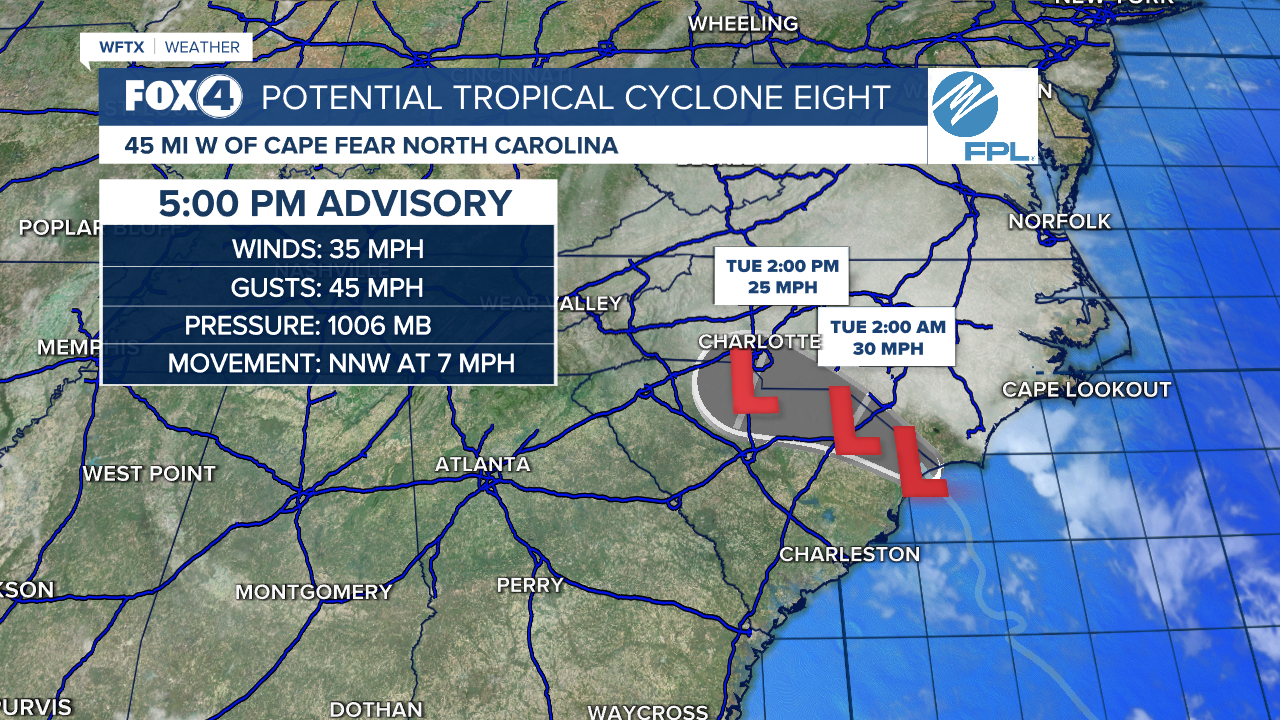
Potential Tropical Cyclone #8 is producing tropical storm conditions along the North Carolina coastline, including coastal flooding in southeastern NC. The disorganization of the system is preventing it from being named, but impacts remain the same as a tropical storm.

At 5 pm, the system is moving toward the north-northwest near 7 mph. A northwestward motion is expected during the next day or so, and the low will move inland across the Carolinas tonight and Tuesday.
Surface observations indicate that maximum sustained winds have decreased to near 35 mph with higher gusts. Continued weakening is expected during the next day or so, and the low is forecast to dissipate over the Carolinas by early Wednesday.
This is the last public advisory issued by the National Hurricane Center on this system.
THREATS:
WIND: Gusty winds are expected to diminish this evening along the coast of North Carolina.
STORM SURGE: Water levels remain elevated along portions of the southeastern North Carolina coast and will begin to subside after the next high tide cycle.
RAINFALL: The system will bring an additional 4 to 8 inches of rainfall, with isolated totals of 10 inches, across portions of southeast North Carolina into tonight. Across northern South Carolina and the remainder of North Carolina, 2 to 4 inches of rainfall, with isolated totals near 8 inches, particularly in the North Carolina Blue Ridge, are possible through Tuesday. Over southeast Virginia and the Virginia Blue Ridge, expect 2 to 4 inches of rainfall, with locally higher amounts, tonight through Wednesday. This rainfall brings a risk of flash and urban flooding and minor river flooding.
TORNADOES: A few tornadoes may occur through this evening across eastern North Carolina. SURF: Swells are forecast to affect portions of the coast of the southeastern United States through tonight.
WATCHES/WARNINGS:
A Tropical Storm Warning is in effect for South Santee River, South Carolina northward to Ocracoke Inlet, North Carolina.
CLICK HERE, for a look at the rest of the Tropics.


